


Five Hidden Gems In Phú Yên (Đắk Lắk) That Most People Drive Right Past
Most people who go to Phú Yên — now officially part of Đắk Lắk province after Vietnam’s 2025 administrative merger — go to the beach, eat bún cá, and drive back. Fair enough. The beach is excellent. The bún cá is the best in Vietnam. But inland, barely signposted and mostly known only to locals, there’s a version of Phú Yên that almost no visitor ever finds.
Waterfalls dropping over basalt columns that look like a submerged Gành Đá Đĩa. Pools of water so still and so green they look photoshopped. Streams running cold under old-growth forest canopy so dense the sun doesn’t reach the water. A sleeping island at the edge of Vũng Rô Bay with “giant footprints” scattered across the rocks.
None of these are on the standard tour itinerary. Most of them don’t have entrance fees. A few require a motorbike, a good sense of direction, and the willingness to ask a local for help finding them. All of them are worth it.
Here are five hidden gems in Phú Yên that the algorithm hasn’t found yet. Go before it does.
1. Thác Vực Hòm — Gành Đá Đĩa, But Upside Down In The Mountains
There’s a reason people call Thác Vực Hòm “Gành Đá Đĩa giữa núi rừng” — Gành Đá Đĩa in the middle of the forest. The same volcanic basalt columns that make the coastal reef so extraordinary turn up here too, rising on either side of a 20-metre waterfall that drops into a wide, jade-green pool. Except here they’re vertical, stacked, and framed by dense forest canopy instead of the South China Sea. It looks, if anything, more dramatic.
Buried in the hills of thôn Vĩnh Xuân, xã An Lĩnh, huyện Tuy An — roughly 45 km north of Tuy Hòa — Vực Hòm is the kind of place you only find by committing to finding it. The road in is rough, the last kilometre is on foot, and the mobile signal disappears somewhere on the way. Bring everything you need from the city, because there’s nothing on-site. In return, you get a natural swimming hole, a landscape that genuinely looks like Iceland’s Svartifoss waterfall, and the strong possibility of having it entirely to yourself on a weekday.
Best time to go: November to April when the waterfall runs full. In the dry season (May to August) the flow slows to a trickle but the pool remains beautiful and calm — better for swimming, less impressive for photography.
How to get there: From Tuy Hòa, head north on QL1A, turn left at Hòa Đa onto road ĐT634 toward the Vân Hòa plateau. After 13 km, turn right toward xã An Lĩnh, continue 7 km to the end of the road, then walk roughly 1 km through farmland to the falls.
Bring your own food, water, a life jacket for swimming, and a torch if you’re staying past sunset. Go in a group — the area has no phone signal and it’s easy to lose the path back.
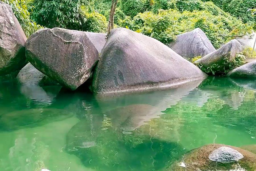
2. Vực Phun — Where The Water Punches Up Through The Rock
The name tells you everything: vực means deep pool, phun means to spray or erupt. This is a 50-metre geological oddity in xã Hòa Mỹ Tây, huyện Tây Hòa — about 20–38 km southwest of Tuy Hòa depending on your route — where streams from the Đèo Cả mountain range converge on the upper reaches of the Bánh Lái River, hit a hard granite shelf, and fall into a soft rock basin worn deep by centuries of erosion. The result is a pool that appears to bubble and spray upward, as if something large is breathing beneath the surface. Hence the name.
The cliffs surrounding the pool are steep and layered, the water inside is the colour of deep jade, and the whole scene sits enclosed in old-growth forest that makes the temperature drop the moment you step into it from the road. A local legend about a giant snake guarding the valley adds appropriately strange atmosphere.
Vực Phun isn’t easy. The road to the parking area is straightforward enough, but the 1–2 km walk in follows the riverbed — over rocks, through shallow water, past a deep natural lake you’ll have to cross. Bring a SUP board or kayak if you have access to one: paddling the still upper pool at dawn, surrounded by mist and granite walls, is one of the finest experiences available within an hour’s drive of Tuy Hòa.
Best time to go: March to July — the dry season sweet spot. The water is at its clearest and calmest, and the forest is green. Avoid September to December when the river can rise dangerously fast.
How to get there: From Tuy Hòa, take QL1A south to thị trấn Phú Lâm, turn onto QL29 toward the Đá Đen mountain range and follow the Bánh Lái River upstream. No formal signage — use Google Maps and ask locals when you get close.
No services on-site. Bring your own equipment, life jackets, and a local guide if you can find one. This is not a place for weak swimmers or solo visitors.
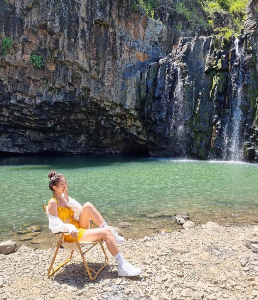
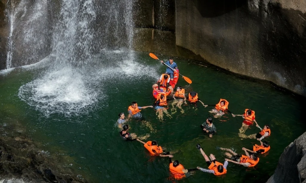
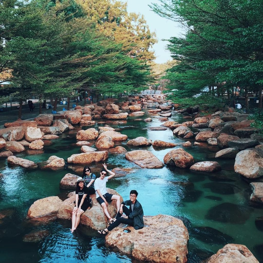
3. Suối Đập Hàn — The Stream That Looks Like A Japanese Rock Garden
Suối Đập Hàn — also called Suối Hàn, Đập Hàn, or, slightly dramatically, Thác Linh Hồn — sits at the foot of Núi Đá Bia, about 27 km south of Tuy Hòa on the way to Đèo Cả. It’s a confluence of small mountain streams running down from the Đại Lãnh range, and where they meet, they create something that looks like it was arranged by a landscape architect: flat-topped stones scattered across the shallow water in irregular patterns, like an oversized Japanese rock garden where the “sand” is a clear, cold stream and the “stones” are boulders you can sit on, nap on, or jump off.
The outer area — what you see first — is a wide alluvial flat with short grass, coconut palms along the bank, and a section of calm, kayak-friendly water. The inner area, accessed by scrambling upstream over the rocks, is wilder and more dramatic: narrow channels, deeper pools, the sound of the water amplified by the valley walls.
This is the most accessible and family-friendly of the five hidden gems in Phú Yên on this list. There’s a small food stall near the entrance where you can buy grilled chicken and seafood. You can rent kayaks. Camping on the grass flat is popular and genuinely lovely — fall asleep to the sound of the stream, wake up with the birds.
Best time to go: January to August. The stream runs year-round, but the dry months are safer and more beautiful.
How to get there: From Tuy Hòa, follow QL1A south toward Đèo Cả. Just before the tunnel, turn left into thôn Hảo Sơn and follow the road approximately 200 metres to the turnoff for Đập Hàn. For the stream area (rather than the dam), turn left and drive a further 1 km uphill.
The downstream section looks calm but has strong current — swim upstream only. A local food vendor near the entrance can advise on conditions.
4. Suối Lạnh — The Stream That Never Runs Dry
Suối Lạnh — Cold Stream — earns its name. Tucked into xã Hòa Thịnh, huyện Tây Hòa, about 32 km southwest of Tuy Hòa on QL25, this is the one that locals call “dòng suối không bao giờ cạn” — the stream that never dries. And unlike some local claims, this one appears to be accurate: even in the deepest dry season, when other streams around Phú Yên have reduced to warm trickles, Suối Lạnh keeps flowing cold.
It’s smaller and quieter than the other four locations on this list, which is partly the point. No dramatic waterfall, no geological spectacle — just an ancient, reliable stream running through dense secondary forest, fed by springs that locals have been coming to for centuries. A legend is attached to it: a feudal lord whose son was ill, a dream, a visit to the spring, a miraculous recovery. The spring has been a place of quiet significance in the local community ever since.
For visitors, it’s a place to swim in genuinely cold, clear water on a hot day, to walk the forest trails that follow the stream uphill, and to be somewhere completely unmarked on the tourist map. There are no services, no food stalls, no entrance fee, and usually no other foreigners. Just the sound of cold water and forest.
Best time to go: January to May — the driest, clearest months. The stream is accessible year-round but best avoided during typhoon season (September to December).
How to get there: From Tuy Hòa, take QL25 southwest toward Tây Hòa district. After 28 km, cross the bridge at Dinh Ông, turn left onto road ĐH81, then onto ĐH75. Follow signage for Suối Lạnh — ask locals for the final approach as it’s not well-marked.
Bring insect repellent, sunscreen, and sturdy footwear for the forest trails. The water is cold enough to be genuinely shocking in the dry season — excellent in summer heat.
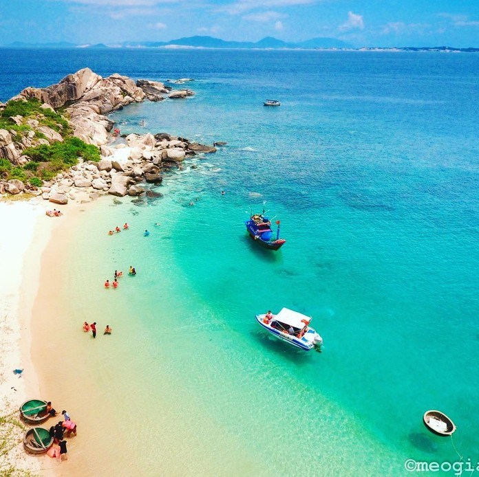
5. Hòn Nưa — The Sleeping Island At The Edge Of The World
Hòn Nưa is technically an island — though the local definition is flexible, since a freshwater stream separates it from the mainland at one point, making it either a peninsula or a very slim island depending on the tide and who you ask. It sits inside Vũng Rô Bay, at the boundary between what was Phú Yên and Khánh Hòa provinces — a natural border marker between two coastlines.
What it is, unambiguously, is one of the most beautiful places in the region. White sand beaches in crescent arcs. Coral reefs visible through water so clear you can see the seafloor from the surface. Towering rocks whose surfaces have been shaped by millions of years of wave erosion into formations that look, without much imagination required, like enormous footprints — the “dấu chân người khổng lồ,” or giant’s footprints, that feature in every account of the island. A lighthouse to climb. Sea turtles in the right season.
It’s reached by speedboat from Vũng Rô port, roughly 45 minutes southeast of Tuy Hòa. The island itself has no permanent residents, no resort development, and — depending on when you go — few visitors. The snorkelling over the coral is among the best accessible reef diving in southern central Vietnam, and the beaches absorb the people who do come without losing their sense of solitude.
Hòn Nưa is nicknamed “thiên đường ngủ quên” — the paradise that fell asleep and forgot to wake up. It’s an accurate description of both the island and the entire Phú Yên coastline it represents: extraordinary, largely undiscovered, and not likely to stay that way forever.
Best time to go: April to August for snorkelling and coral visibility. Boats operate from Vũng Rô port — most day tours depart at 7:30 AM and return by 1 PM.
How to get there: Drive south from Tuy Hòa on QL1A toward Đèo Cả, then descend into Vũng Rô Bay. Speedboats to Hòn Nưa depart from the port area. Day tours can be booked through operators in Tuy Hòa or at the port. Bring snorkelling gear, or rent it on-site.
Check sea conditions before departing — Vũng Rô can be choppy in the afternoon. Morning departures are strongly recommended.
A Note On Getting Here
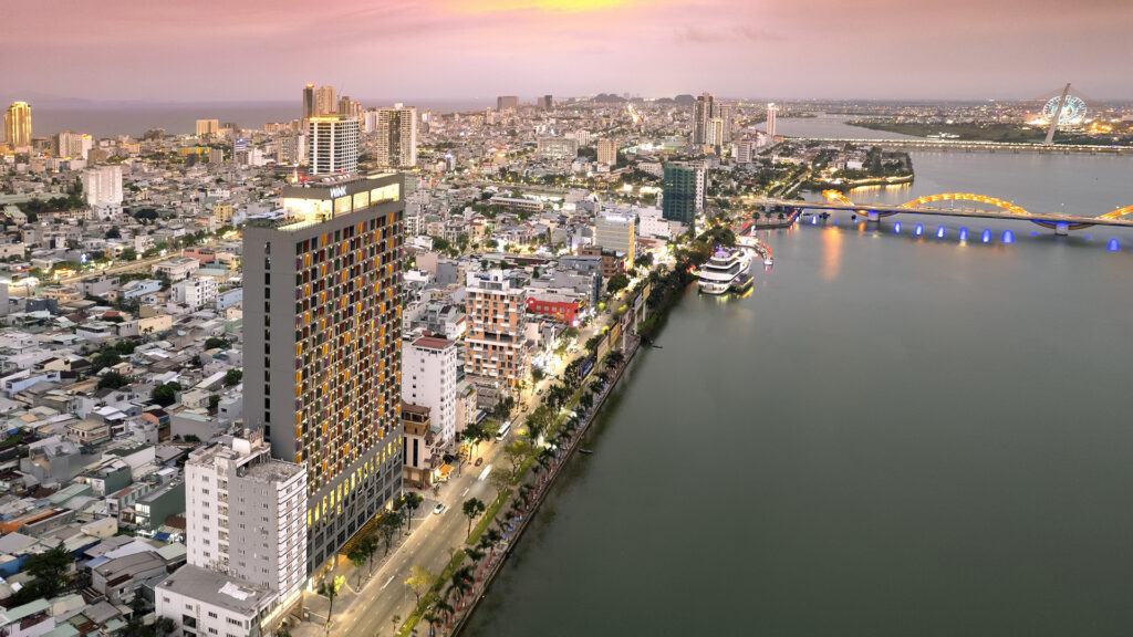
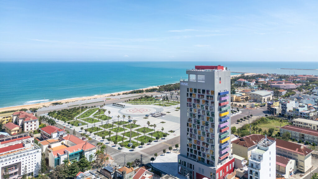
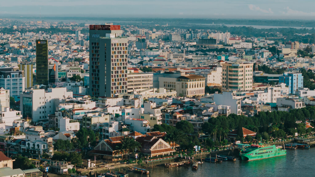
All five of these locations sit within the former Phú Yên province — now part of Đắk Lắk following Vietnam’s 2025 administrative merger — and are accessible from Tuy Hòa city. The best base in town remains Wink Hotel Tuy Hoa Beach at 1 Điện Biên Phủ: central, walkable to the beach and the main square, with the hotel’s Wink Guides team available 24/7 to advise on routes, conditions, and the best time to visit each location.
A motorbike — rentable through the hotel or from local shops — is the right vehicle for Vực Hòm, Vực Phun, Suối Đập Hàn, and Suối Lạnh. Hòn Nưa requires a speedboat. Plan a full day for each of the inland locations: the journey is part of it.
The dry season window from January to August is when all five are at their best. Go during the week to avoid the domestic crowds that appear on weekends and public holidays. And go soon — the algorithm is catching up.
Read more: For everything you need to know about basing yourself in Tuy Hòa, our complete Tuy Hoa itinerary covers 3 days and 2 nights in Vietnam’s most underrated coastal city. And for more hidden gems further up the coast, our guide to Vietnam’s most underrated beaches makes the case for going where most people don’t.